(Mount Omoto / Omoto‑dake 於茂登岳, Nosoko Mape 野底マーペー, Fukai‑Omotodake 桴海於茂登岳, Kabira Terrace)
Ishigaki is paradise for nature lovers and casual hikers alike. Most trails are short to moderate, with lush jungle, coastal views, and surprising biodiversity. Signage can be limited and often in Japanese, so we’ve listed key facts, starting points guidance, safety tips and even the actual trail routes to help you prepare.
Do you need a guide?
Not usually for the popular trails. A guide adds flora/fauna context and route confidence but is optional for well‑trodden routes like Omoto and Nosoko Mape. Plan according to fitness, weather, and daylight.
When to go
Best: Late autumn → spring (cooler, drier).
Avoid: Mid‑summer heat and typhoon days; trails get slick after rain and leeches can be active in warm, wet conditions.
Daylight: Start early; Ishigaki’s dusk comes fast.
Safety & etiquette checklist
1.5–2 L water per person; snacks/electrolytes
Grippy shoes, breathable long pants/sleeves
Sun protection; light rain/wind layer; hat
Fully charged phone + offline map (signal is spotty)
Insects & wildlife: mosquitoes, ticks, leeches; watch for habu (pit vipers)
Take all trash; stay on established paths; turn back before sunset
Choose a weather app like Windy or check Japan Meteorology Agency for on the spot information.
A fresh morning walk, a challenging hike, exploring nature. Feel free what to expect from your walk. We’ll try to show you the starting points and paths as best as we can. Signs aren’t always clear enough and mostly in Japanese.
Currently we provide information on Mape, Mount Omoto, Fukai Omoto dake and Kabira Terrace in Ishigakijima. We like to hike once in a while, aren’t terribly experienced hikers, basically nature lovers. Maybe you could use this as a reference for your own experience and your trail.
Trails at a glance
| Trail | Elevation | Typical time (RT) | Difficulty | Highlights |
|---|---|---|---|---|
| Mount Omoto (於茂登岳 / Omoto‑dake) | 525.5 m | ~2–3 hrs | Moderate–challenging | Okinawa’s highest peak; forest path, small waterfall spur, island views near summit. |
| Nosoko Mape (野底マーペー / Nosoko‑dake, “Maapee”) | 282 m | ~30–60 min (short route) | Short, steep | Roped sections, quick ascent, 360° panorama. |
| Fukai‑Omotodake (桴海於茂登岳) | 477 m | ~2–3 hrs | Moderate, some route‑finding | Fern‑rich forest, limited vistas; leeches possible in wet season. |
| Kabira Terrace viewpoint (near Kabira Bay (Buzamadake) / possible Maetake area) | ~220 m | ~1 hr | Easy–moderate | Gentle ridgeline with sweeping bay views; some faint side trails. |
Other sources: YAMAP
Trail Route maps Omoto, Buzamadake & Maapee
Trail notes
1) Mount Omoto (於茂登岳 / Omoto‑dake) – Okinawa’s highest peak


Why go: Highest point in the prefecture; a jungle hike with coral‑sea views when clear. Allow ~2–3 hrs for a round trip. Paths are stepped/muddy in parts; avoid rainy days.
Extras: A short signed spur leads to a small falls partway up. Views at the very top aren’t 360° due to vegetation; nearby vantage points and the antenna area give wide northern views. The top area has wider parts to have a rest.
Mount Omoto: a forest‑lover’s climb on a sacred mountain in Ishigaki
If you love the calm, sheltered feel of the woods, this trail is for you. Mount Omoto reveals its story step by step—pause often to spot wildflowers, unfurling leaves, and sudden windows through the trees. Keep your senses open: Ishigaki’s earthy aromas blend with tropical sounds and the soft rustle of the canopy. On Omoto, the trail is the star; the summit view is a welcome bonus, especially on a clear day.
Good for: Fit first‑timers and anyone keen to hike Okinawa’s highest summit.
2) Nosoko Mape (野底マーペー / Nosoko‑dake “Maapee”) – Big views, small but iconic mountain


Why go: The fastest route to a spectacular 360° panorama. Short route: ~0.6–0.8 km each way, 15–25 minutes up; steep with fixed ropes. A longer approach exists but most visitors choose the short, steeper trail.
Tip: Go on a clear day; rocks can be slick after rain.
Good for: Sunrise views and families with teens who handle steep ground.
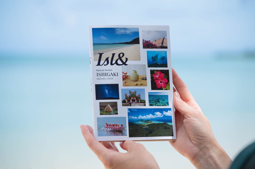
Discover the trail routes with the ISL& Natural Guides Ishigaki Okinawa Japan…your friendly guide to Ishigaki island.
Find out about the legend and love story of iconic Mount Maapee, many personal recommendations, interviews with islanders, maps and much more!
3) Fukai‑Omotodake (桴海於茂登岳) – The “fern trail” & seasonal blossoms

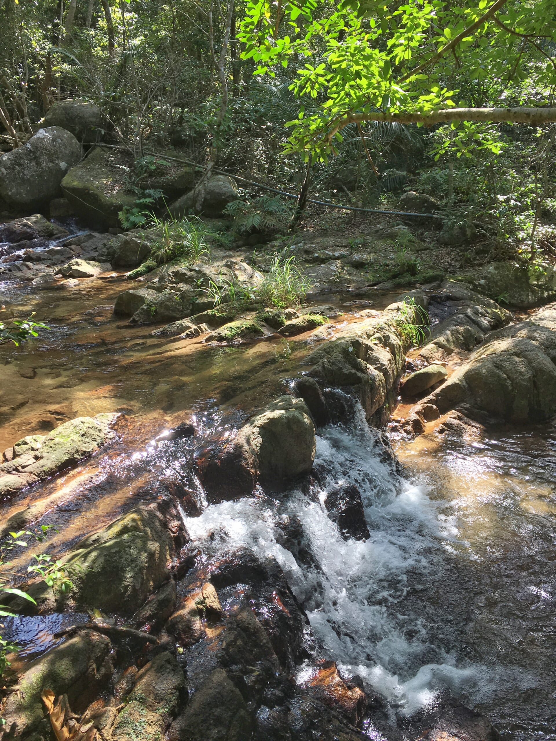

Why go: A quieter, forest‑immersive hike rich with ferns and endemic plants. Time/Distance: Typical model course ~2 h 40 min, ~5 km RT.
Trail feel: Gradual ascent, limited summit views; expect ribbons and some route‑finding. In warm wet weather, leeches are possible—use gaiters/repellent.
Seasonal note: In the broader Fukai/Arakawa area, kanhizakura (winter cherry) often bloom around mid‑February → early March—a unique Okinawan sakura experience.
Good for: Botany lovers and shade‑seeking hikers on warm days.
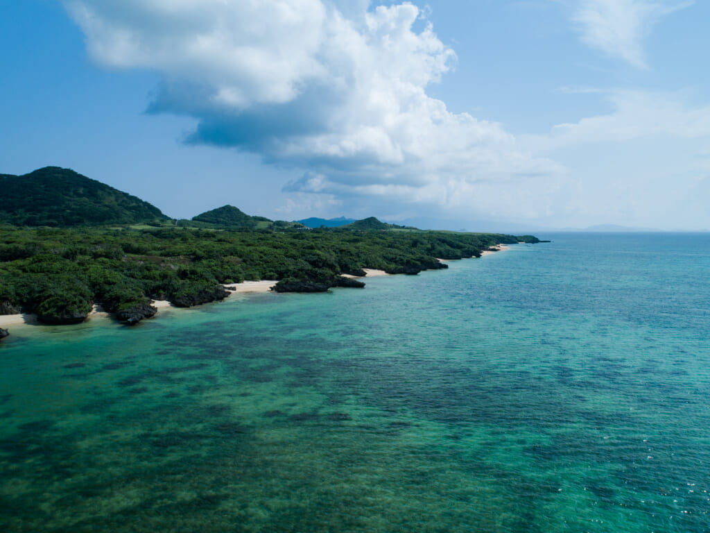
4) Kabira Terrace viewpoint Buzamadake (near Kabira Bay)


Why go: A short ridge walk with a sweeping look at UNESCO‑listed Kabira Bay.
Good for: Pairing a beach day with a light hike and photo stop.
What to pack (quick list)
Water (1.5–2 L pp), salty snacks, hat/sunscreen, breathable long sleeves, grippy shoes (not sandals), light rain shell, basic first‑aid, insect repellent and a headlamp if there’s any chance of finishing late.
Safety disclaimer / 免責事項
Info here is a helpful overview—not a promise of conditions. Ishigaki’s heat, rain, and dense forest can make trails tougher than expected. Trail details may change. Use this guide at your own risk; we are not responsible for accidents or losses. Carry sufficient water, sun/bug protection; turn back if unsure.
Emergency: 119 (fire/ambulance)(消防・救急)/ 110 (police)(警察)/ 118 (Japan Coastguard-coastal emergencies)(海上保安庁)
このページの情報は参考情報であり、最新性や完全性は保証できません。天候や路面状況により難易度は変わります。装備・体調管理・行動判断は自己責任でお願いします。道が不明瞭な場合や天候が悪化した場合は引き返してください。Open printable packing checklist
- Water 1.5–2 L per person
- Electrolytes or sports drink
- Snacks (salt + carbs)
- Sun protection (hat, sunglasses, SPF 30+)
- Breathable long sleeves/pants
- Grippy trail shoes
- Light rain/wind jacket
- Phone with offline map
- Power bank + cable
- Headlamp or small flashlight
- ID, cash/coins
- Small trash bag
- First‑aid kit & personal meds
- Insect repellent
- (Seasonal) Leech protection
- Whistle; tissues/hand sanitizer
- Microfiber towel
- Optional: poles, spare socks, dry bag, camera, swimsuit, pack cover
Emergency (Japan): 119 fire/ambulance · 110 police · 118 coast guard